iPhone Motorcycle GPS Navigation with LIFEPROOF
iPhone motorcycle GPS navigation is a realistic alternative with rugged dry cases such as LIFEPROOF and touchscreen adapted riding gloves. Today smartphones are able to replace the traditional navigators and remove one device out of the equation, bringing more simplicity in the configuration, operational versatility and room in the cockpit. Smartphones are often onboard anyhow and I would rather have a single device that is able to take care of everything, such as handling the phone calls, even reading incoming text messages, playing music, operating action cameras and of course navigating. All that can be done with some of the smartphones such as iPhones including GPS -features. Once the iPhone is paired with the helmet headset, everything is set up from the configuration point of view.
A lot of motorcyclists have helmet headsets which are mostly bluetooth connected with the smartphones and due to better standardization, integrations are today mostly successful. The competition is tight and helmet headsets are under rapid development. The level of quality is already very good and I have been happy to use e.g. Schuberth SRC for few years now. Even the COM -software can be updated which is a plus indeed. There is simply no longer need to run the phone operations through the navigators which also leaves free one more bluetooth connection for passenger or fellow rider communication. Traditionally GPS -navigators worked as intermediators between the headset and the phone, but due to numerous phone models and types, the configurations have been less user-friendly and even problematic to keep up. Today e.g. CARMIN has integrated the GPS -navigators very closely with the iPhones and iPads providing much better features and level of usability, but still there are a lot of smartphones outside the support.
Especially touring motorcyclists install the smartphones in the cockpit, but mostly not for navigation. Riders are used to be in touch and connected. The phone ringing and receiving messages in the pocket is simply not wanted. There are many advantages when the phone is at hand. The rider can see the short notifications and messages on the display normally, but also operate the music player for example. A step to include the navigation in the list is very small. There are also voice commands to simplify calling and some of the smartphone functions which supports the use even further. The best GPS -navigators are able to transmit the calls and control the medial players too, but the integration is hardly user-friendly and requires more memory capacity from the navigator. For example the phonebook needs to be downloaded in the navigator in order to make a call using the navigator. This sounds odd and unnecessary.
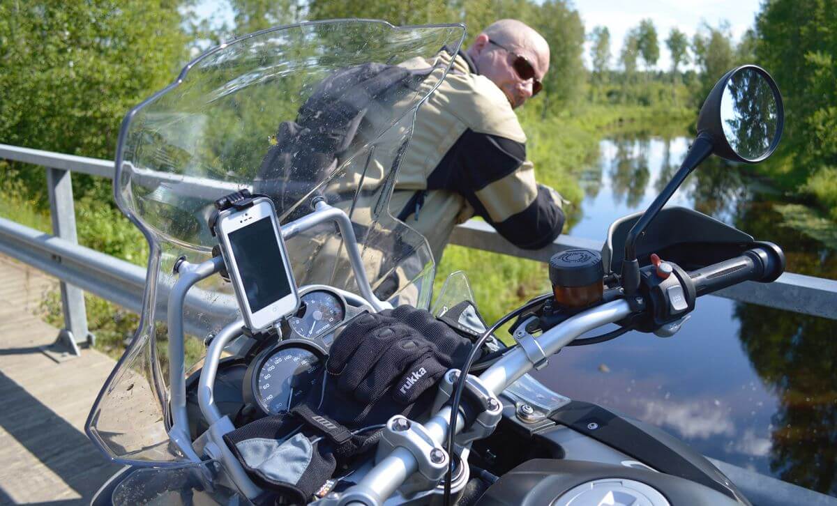
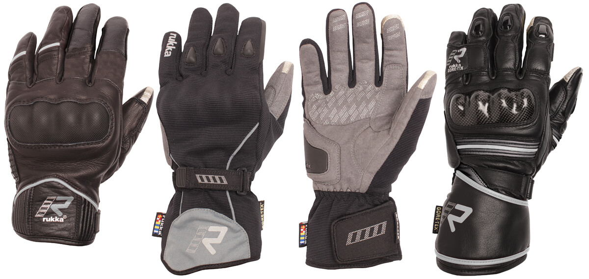
In addition the navigators are not able to display the text messages which is a clear shortcoming, but hardly impossible to fix. On the other hand, the best GPS -navigators are able to create versatile route alternatives, so called winding routes and avoid certain routing factors, but these differences apply only to GoogleMaps navigation or more simplified applications. One clear advantage is the big touchscreen display which is also glove friendlier. Today the best MC -navigators have already 5 inch screens and e.g. the iPhone5 has a 4 inch display. Tablets would go even further and the iPadMini is probably the biggest device which could be installed in the MC -cockpit. Some of the riding gloves such as RUKKA Virium with Gore-Tex® are made using touchscreen applicable materials which clears the old problem of operating the smartphone gloves on. Those materials are usually placed on the index finger tip and the thump on both gloves. Without the touchscreen materials, the smartphones can not be operated well enough gloves on, although split leather surfaces interact somewhat with the touch screens.
iPhone Motorcycle GPS Navigation Apps
The iPhones have several alternatives for motorcycle GPS -navigation, but even the standard iOS Maps application is very dynamic and utilizes a full screen view both in horizontal and vertical position. Still as long as the application is not designed for MC -use gloves on, the size of text and buttons is mostly smaller than what would be ideal. Therefore offline apps are usually better than online applications. When a navigation app offers voice- and proper display guidance turn by turn with trip computer including speed readings, the app. becomes useful, but there is a huge technical difference between the free or inexpensive applications and the traditional navigation programs. That is the location of the map source. As long as the map information is not in the smartphone itself, the rider needs a constant mobile internet connection which is hardly available everywhere, especially abroad and in the backcountry. Therefore online navigators are basically only good for national urban touring. Never the less online maps are always up to date and require no memory in the iPhone itself.
The iPhone 5 display is slightly smaller than what the best MC -navigators are offering. The iPhone touch screen buttons, text and the links are also smaller due to higher resolutions which makes some of the operations on the other hand less accurate with gloves on. Especially when the biker is on the move, only basic functions are still useful enough to handle, but the same applies pretty much to traditional GPS -navigators too. The iPhone LIFEPROOF fre case touch screen protecting foil is slightly reflective and requires a correct angle of view, but thanks to the handlebar clamp and cradle technique, adjustments are easily made.
iPhone iOS Maps Navigation App
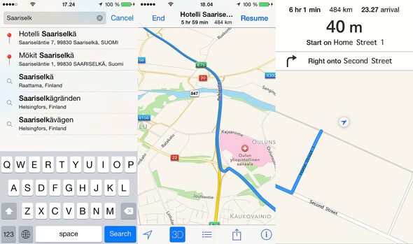
The standard iPhone navigation app iOS Maps runs very well online and offers spoken directions with street names. The 3D -map view is very dynamic and interactive. The iPhone address book and Safari internet browser are integrated which makes the use very user-friendly and quick. There are only few basic statistics and no speed reading. The map source can not be downloaded for offline navigation, but the upside of using online navigator apps is that the map information is always the latest without separate updating. Changes come in all the time and updates 4 times a year is a minimum for frequent travelers.
iPhone GoogleMaps Navigation App
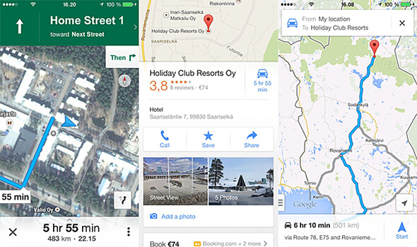
One of the most versatile online navigation app would be the iPhone GoogleMaps. Purely from the navigation point of view, the leading offline software comes from the navigator manufacturers. The GARMIN StreetPilot® and the TomTom Navigation offers the best basic navigation features and an integration with some of the smartphones such as iPhones. The difference to the GoogleMaps and the iOS Maps is fundamentally significant, but they all bring real time features in the play. The advantage of using the GoogleMaps is that there is a lot of POI -information integrated in the maps and with other Google services such as dynamic trip planning features. Naturally the information is mostly related with the urban areas and remote explorer hardly benefit from it. From the basic navigation point of view, the iPhone GoogleMaps is not integrated with the address book and there is no lane assistance with a junction view.
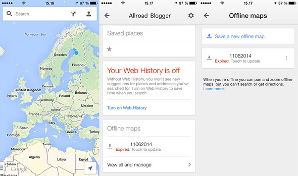
The iPhone GoogleMaps navigation is also possible in offline by saving a specific map area in the device memory. Simply open the GoogleMaps app, go to the personal settings, offline maps archive and download the preferred screen area. The app will automatically show how big area can be saved. The size of the map depends on the storage space available on the device, but the amount of information in the maps is huge, the iPhone may limit the free space for the app and therefore this is hardly an option for motorcycle touring abroad, unless the rider is able to download new maps almost daily.
The iPhone GoogleMaps offers also more map types and satellite views which are especially useful in spontaneous detour routing. The Google has constantly developed the navigational features. There will be probably even more useful information and dynamic features. At least the iPhones are able make the most of it already today. Once the bike is parked somewhere, the iPhones with the urban commuter apps. are able to navigate more further by using the public transportation and the sidewalks. The GoogleMaps is able to match and go beyond the traditional navigator`s limits, although the navigator manufacturers are also developing online features such as real time traffic and weather related information. Never the less, the motorcycle rider could use both of the systems with the smartphone and enjoy all the benefits and modern possibilities as long as there are rugged dry cases mountable in the cockpit.
iPhone GARMIN Viago Navigation App
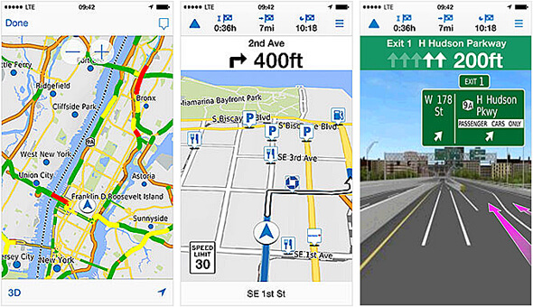
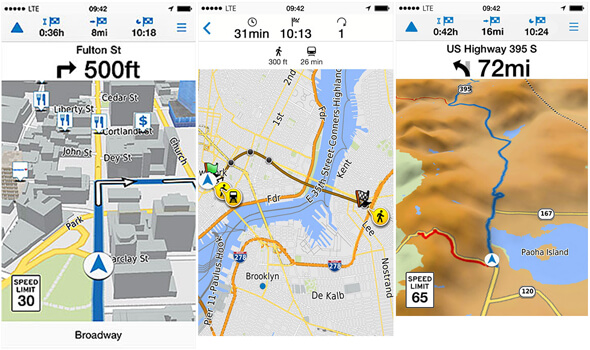
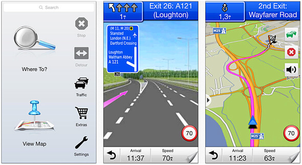
The iPhone GARMIN Viago navigation app is both an online and offline navigation software. The basic Viago app without additional upgrades uses online map source for navigation and services, but even the premium offline mode requires DATA -streaming for the dynamic real time features. Exceptionally the speed reading comes along with the speed limit signs and the lane assistant offers photo realistic 3D -junction views for major roads, just like the traditional GPS -navigators. A 3 day weather forecast for the destination is also there and the traffic situation around the rider by using traffic light colors on top to the map graphic. Unfortunately most of the dynamic features come with the upgrades and require constant online connection.
The GARMIN Viago navigation app can be upgraded with premium features which allow to download paid map areas from a www.here.com service made by NOKIA into the iPhone memory and navigate in offline mode. Unfortunately the downloadable area is quite small and hardly any good for MC grand touring purposes. Note that the HERE -homepage functions also as an online navigation platform simply by using any smartphone browser application and downloading a map area, is free of charge. Along with the full premium GARMIN Viago navigation app upgrade comes an automatic rerouting according to the traffic situations ahead, spoken turn by turn directions including local landmarks and traffic lights, active lane guidance graphics next to the map view, navigation with public transportation network and bird view navigation with a panoramic 3D -terrain view. Most of the dynamic online features are available only for major cities.
iPhone GARMIN StreetPilot® Navigation App
The iPhone GARMIN StreetPilot® navigation app has an internal offline map source which can be updated to the latest online free of charge. The voice guidance includes turn by turn street names and 3D building views. The map view adapts both to 2D or 3D portrait and landscape positions. The app offers 3 different routing alternatives and lane assistance with photo realistic junction views. When planning a route, the GARMIN StreetPilot® is able to arrange several destinations which can be also manually reorganized anytime or updated with a spontaneous detour along the road. The speed reading and the map view shows the speed limit in question for most of the major roads and the rider is able to report changes or errors which are transferred when the smartphone is next time online.
The Google search is integrated with the GARMIN StreetPilot® and the rider can place a call or start navigating directly from the listings. The app includes millions of POIs, national emergency contacts and local services. When the rider exists the main road, the EXIT -services on the display provide information on local services near by. This is very useful ”take a break” -feature in the app which can be used on the move without too much tabbing. The urban exploring is also available and the StreetPilot® utilizes the public transportation in several cities and metropolises.
The iPhone StreetPilot® navigation app integrates with the iPhone address book. The app has also a compass and a versatile trip computer features with odometer and statistics. The basic navigation view can be customized with the trip computer features. When online the app shows 5 day weather forecast for the location and the destination in question. Social media features include sharing the location or the POI in the Facebook and simply by using text messages. Additionally GARMIN offers traffic camera images service of the road ahead, giving the opportunity to estimate the nature of the possible traffic jam soon in front of the rider.
iPhone LIFEPROOF fre Rugged Dry Cases
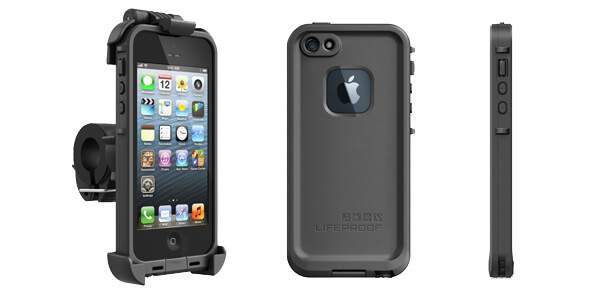
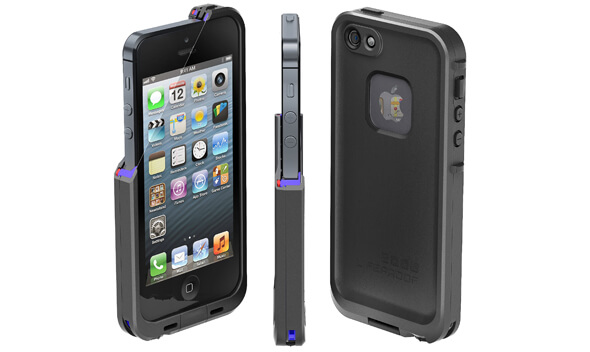
LIFEPROOF is one of the leading rugged iPhone dry case producers and the LIFEPROOF fre case suits very well for motorcycling and especially for more adventurous allroad touring. The structure is impact resistant, the lining absorbs shocks and the touchscreen is protected with a foil. The dry case keeps the iPhone safe against the elements and allows the use of all iPhone features and ports. The back side camera is enhanced with an anti-reflective optical glass lens and the flash remains naturally functional. The iPhone speaker forms a subwoofer effect with the dry case and therefore even phone calls before the headset is connected, are not a problem. This can happen e.g. when the rider has just returned to the bike and put the helmet on when the phone starts to ring before the bluetooth is connected. The FRE -handlebar mount adapts to different size of bars with a quick release clamp and the cradle can be easily rotated to vertical or horizontal positions, but also locked in place. The key features of the iPhone LIFEPROOF fre dry case are:
- Rugged structure with shock absorber
- Display protected
- Enhanced sound features
- Optical glass lens for the camera
- Allows full iPhone features
- Full access to ports & controls
- Weight 29,8 grams or 1.05oz
- Watertight up to 2 meters or 6.6feet
- Military STD 810F shock proof
- IP68 water & dust proof
- Universal handlebar mounting system
- Slim design for everyday use
The LIFEPROOF -dry cases are made with the highest accuracy and inside the case there is no room for additional layers such as touchscreen protecting films. The setup requires an USB -charger plug in the cockpit to back up the iPhone. Active use simply requires constant charging. Unfortunately the LIFEPROOF fre dry case lightning port has to be opened for that which leads to further protection. The standard iPhone power cable is not sealed with the case, but any handyman can easily seal the port when the lightning cable is plugged in using blue tack or similar substances.
iPhone LIFEPROOF fre Case Mount Cradle
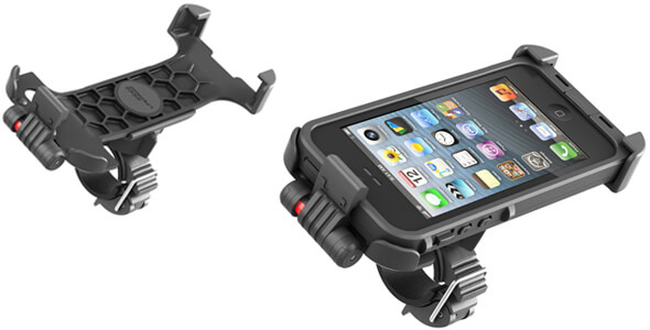
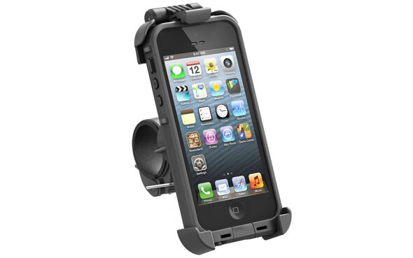
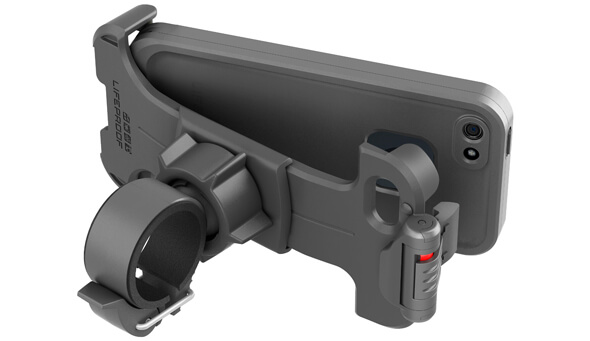
The iPhone LIFEPROOF fre case has exceptionally a useful mount cradle which can be quick installed to different size handlebars and frames. The universal clamp itself has 3 size of rubber layers which absorb vibrations efficiently and keep the display readable. A light weight structure helps to minimize the vibrations even further. A 360 degree ball head adjustment with a big lock nut, makes view angle tuning simple. The iPhone LIFEPROOF fre case can be locked in the cradle and removed with one hand. The latch has a color indicator showing when the iPhone is locked in place. This is important for high vibration conditions such as offroad and very useful when visiting fuel stations etc. and leaving the bike out of sight. The mount cradle allows full access to the iPhone display and buttons, but also to use the camera features. The key LIFEPROOF fre case mount cradle features are:
- Allows full iPhone features
- Quick release & lockable mount cradle
- Accepts the case facing backward
- 360 degree ball head quick adjustment
- Universal quick release clamp
- Vibration absorbing clamp
- Light weight & strong structure
iPhone LIFEPROOF fre HD Action Camera
iPhones and some of the smartphones with LIFEPROOF fre dry case can be also used as HD -video camera or action camera controller which is another area where proper housing is a game changer. For example the iPhone has a two way camera and the rider could film to both directions very easily as long as the windscreen is clear or the device is peeking around the edge. iPhones and some of the Android based smartphones have also GoPro HERO3+ HD action camera controlling applications which allow to preview the video, fine tune camera angles, start & stop filming and change any of the camera settings, but also to share the footage online. Similar features can be found from the GARMIN Zumo 590LM motorcycle GPS navigator which is integrated with the GARMIN Virb Elite HD action camera, but it`s not yet very common feature. Never the less, smartphones are more versatile and a simplified ready to go configuration which makes traveling more enjoyable and saves the best moments from the trip. The rider can even turn the iPhone facing backwards in the cradle and film selfies.
iPhone Touchscreen Motorcycle Gloves
The iPhone touchscreen can not be operated with traditional motorcycle gloves and since taking the gloves off is not an option, the biker needs a pair of smartphone adapted MC -gloves such as RUKKA Rytmi, –Virium or -IMATRA. There are also conductive liquids and simple glove treatments to update the traditional gloves for touch screens, but since riding gloves are one of the most important contact surface to the motorcycle and instrumentation, I would rather use only the best gloves. The RUKKA motorcycle gloves have special fingertips with touchscreen conductive materials on the tip of the index finger and the thumb. As a reference, the traditional GPS -navigators have additionally a conductive layer on top of the screen to form a functional circuit. There are at the moment limited numbers of glove brands that are offering smartphone touch screen features, but I am sure that others will follow soon.


